


Trailz – Let’s Ride!
2.39.00 Reviews
App Specs
- Version
- 3.20.5
- Updated On
- License
- Free
- Downloads
- 10,000+
- Developer
- Patric L Kranz
- Categories
- Maps & Navigation
- Platform
- Android
Screenshots
 Analysis by AppCompare
Trailz – Let’s Ride! is the kind of navigation app that makes sense when your destination is not a street address but a trail entrance, a forest route, or a stretch of open ground where ordinary map apps become less useful. I approached it as a companion for ATV, UTV, and snowmobile outings, and my overall impression is mixed: the idea is focused and practical, but the experience asks the rider to prepare carefully rather than simply open the app and trust it.
Published by Patric L Kranz, this free Maps & Navigation app is aimed at people who spend time away from conventional roads. It is available for Everyone, supports devices running Android 7.0 or later, and has reached over ten thousand installs. The current version is 3.20.5, while the store summary presents it as a tool for off-road trail navigation. That description is brief, but it points to the app’s real appeal: it is built around the needs of recreational riders rather than daily commuters.
My main takeaway is simple: Trailz is more interesting for planned outdoor trips than for casual, last-minute navigation. If you already know the area, understand the risks of riding beyond public roads, and are willing to check the screen before moving, it can become a useful part of your kit. If you expect the polished guidance, broad place information, and effortless accessibility of a leading road-navigation service, you may find it limited.
How readable navigation feels away from ordinary roads
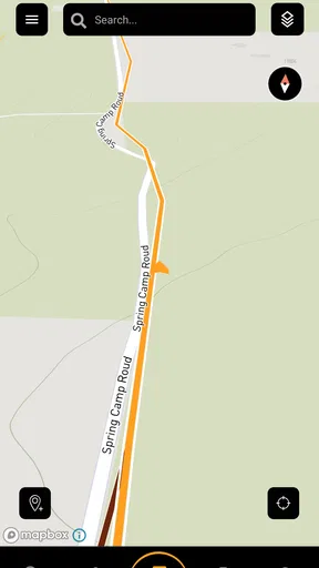
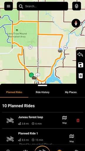
The first challenge with off-road navigation is not finding a destination. It is understanding what the map is showing when several paths look similar, when a trail changes direction gradually, or when the surrounding landscape offers few visual landmarks. A road app can often rely on clear lanes, named streets, turn instructions, and recognizable buildings. Trail navigation has to communicate a much less tidy environment, so the rider needs to read the map as a planning surface rather than as a sequence of guaranteed commands.
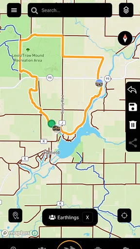
That distinction matters for Trailz. I would use it before setting out to inspect the overall shape of a ride, identify likely junctions, and decide where I might stop to confirm my position. I would not treat the phone as something to stare at continuously while operating an ATV, UTV, or snowmobile. The safest workflow is to study the route while stationary, remember the next meaningful change, and keep the device available for deliberate checks rather than constant attention.
For riders with reduced visual acuity, map readability becomes a practical issue rather than a cosmetic preference. Small trail lines, crowded labels, glare, dust, vibration, and a bright outdoor background can make any navigation display harder to interpret. Trailz may be useful on a larger phone held securely in a vehicle, but I would test the map at home and in daylight before relying on it. A route that looks obvious indoors can become surprisingly difficult to distinguish beside a wooded trail.
I also recommend using a simple pre-ride routine: zoom out to understand the complete outing, zoom in to inspect confusing sections, then note the places where a wrong turn would be costly. This is one of the more valuable ways to use a specialized trail app. Instead of expecting it to solve every decision in real time, I treat it as a visual briefing tool that helps me build a mental picture of the area.
Worth Reading Before You Choose

EA SPORTS FC Mobile 26 Is a Bigger Football Game, but It Takes Time

Flipboard Shows What News Apps Must Do Beyond the Feed

Switching to Android Auto Means Rethinking Your Driving Routine

Google Calendar Makes a Crowded Week Easier to Manage

Ludo King Makes the Most of the Minutes Between Plans

Baby Panda World Brings Quick Play to Modern Phones, but Its Game Library Feels Busy
The app’s average rating is 2.3 from around twenty ratings, with nine written reviews. That is a small sample, but it is still a reason to approach the product with realistic expectations. I would install it before a major trip, explore its interface, and confirm that it behaves well on my particular phone before making it the only navigation aid in a remote area.
Reading the route when attention is divided
Off-road riding already demands attention from the hands, eyes, and body. A rider may be watching for ruts, loose stones, branches, changing snow, other vehicles, or a sudden slope. A passenger in a UTV may be able to help with map checks, while a solo ATV rider has fewer opportunities to interact safely. This difference changes who can get the most from the app.
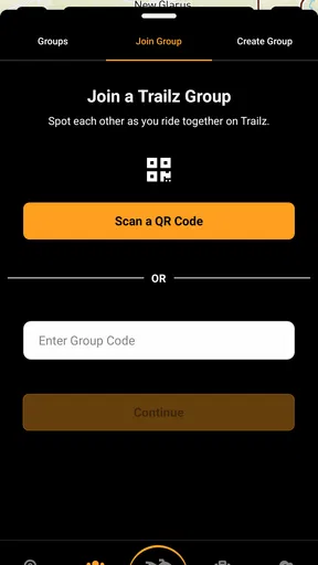
I see Trailz as more accessible when the navigation role is shared. In a UTV, one person can remain responsible for route checks while the driver concentrates on the terrain. In a group, a leader can review the next section at a stopping point and communicate the plan to everyone else. That arrangement reduces the need for rapid screen interaction and makes the app less dependent on perfect vision, quick touch accuracy, or constant concentration from one person.
For solo riders, I would keep interactions short and predictable. Stop before changing the view, checking a junction, or searching for a new route. A phone mount can improve visibility, but mounting a device does not make it safe to operate while moving. The app can support a careful routine; it cannot remove the physical and cognitive demands of off-road travel.
Motor and sensory considerations on a moving vehicle
Touch controls are naturally more difficult when a vehicle is vibrating, when the rider is wearing gloves, or when fingers are cold. Snowmobile users face an especially demanding combination of winter clothing, reduced dexterity, glare from snow, and potentially short periods in which the screen can be handled comfortably. ATV riders may deal with mud, dust, rain, and uneven ground. These are not minor inconveniences; they determine whether a navigation tool is usable in the moment.
For that reason, I would prepare Trailz before putting on gloves. Open the route, set the viewing scale, and make sure the device is positioned where it can be checked without awkward reaching. If I needed to make several changes during a ride, I would consider that a sign to stop rather than a sign that the app should be operated one-handed. A passenger or riding partner can make this much easier in a UTV, but the same approach is not available to everyone.
People with limited hand strength or reduced fine-motor control may find the preparation stage manageable while the live-riding stage remains frustrating. The most inclusive use is therefore not necessarily the most interactive one. Trailz works better when the rider turns it into a low-interaction reference: plan the route, memorize key points, and consult the display only during safe pauses.
Sensory load is another consideration. A map can be visually busy even when it contains useful information, and the surrounding environment may already be loud, windy, or distracting. I would avoid relying on visual interpretation alone in a complicated section. A written route plan, a paper overview, or a second person who knows the itinerary can provide useful backup. This is not a criticism unique to Trailz; it is a reminder that digital trail navigation should complement, not replace, outdoor judgment.
Where the app fits different riding situations
The strongest use case is a recreational outing where the rider wants a dedicated trail-oriented reference instead of a road-first navigation experience. It may suit someone planning a weekend route, checking the relationship between trails, or keeping a broader sense of direction during an established ride. The ATV, UTV, and snowmobile focus gives it a clearer identity than a general driving app, especially for people whose destinations do not have conventional addresses.
A realistic example would be a UTV group preparing for a day in unfamiliar terrain. Before leaving, the passenger responsible for navigation could review the route in Trailz, identify places where the group should pause, and keep the phone available for position checks. The driver would not need to interact with the screen, and the group could agree on what to do if riders become separated. In this context, the app is not being asked to make every decision; it is helping the group organize the ride.
For a solo snowmobile trip, I would be more cautious. Winter conditions can make a small problem become a serious delay, and a phone may be affected by cold, moisture, or a depleted battery. Trailz could still be part of the preparation, but I would carry an independent backup and tell someone the intended route. The app is more suitable as one layer of planning than as the sole safeguard.
It may be less appropriate for someone who needs turn-by-turn guidance with minimal interpretation. A mainstream road-navigation app is usually better for city streets, addresses, traffic-aware driving, business searches, and familiar voice-led directions. A dedicated trail app makes more sense when the challenge is understanding off-road space rather than reaching a numbered building.
It is also not the ideal choice for a user who expects every trail to be equally clear, current, or legally accessible simply because it appears on a screen. Outdoor routes can change because of weather, maintenance, private land, seasonal restrictions, or local rules. I would confirm access with local authorities, land managers, or an established riding community before setting out. A map display is not permission to enter an area.
Comparing Trailz with the usual alternatives
Compared with a general maps app, Trailz has a narrower purpose. That focus can be an advantage because the user is not forced to translate a road-oriented interface into an off-road plan. General apps remain stronger for addresses, nearby services, traffic, public transport, and ordinary driving. If my trip includes a long highway approach followed by a trail ride, I might use a regular maps app for the approach and Trailz for the off-road portion.
Compared with a paper map, the app is easier to update during planning and more convenient to carry, but paper remains valuable when a battery, signal, screen, or mounting setup becomes a problem. A paper map also encourages a wider view of the area, which can be useful when deciding how to reroute around an obstacle. I would not choose between the two as if they were rivals; I would use the phone for closer inspection and keep a physical backup for orientation.
Compared with a premium outdoor navigation service, Trailz may appeal to someone who wants to try a specialized tool without paying an upfront download price. The app is free, although its in-app purchases range from $9.99 to $59.99 per item. That makes it important to understand which parts of the experience are available without payment and which optional purchases matter to your planned use before depending on it for a trip. I would explore the free experience first and avoid buying anything until I knew the app fit my device, riding style, and local routes.
The trade-off is that a more established outdoor platform may offer a broader ecosystem, more mature route planning, or stronger support for users who need a highly polished workflow. Trailz’s appeal is its direct connection to ATV, UTV, and snowmobile use, but that specialization alone does not guarantee that it will suit every region or every accessibility need.
Practical preparation that makes the experience better
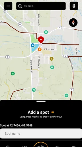
My first tip is to conduct a dry run before the real outing. Install the app at home, open the areas you care about, and practice changing the view while seated and stationary. This reveals whether the controls feel comfortable, whether labels are readable on your phone, and whether the screen layout works for the person who will actually handle navigation. It is much better to discover a confusing gesture in the driveway than beside an unfamiliar junction.
My second tip is to create decision points rather than relying on a continuous stream of attention. Mark mentally where the route changes direction, where a trail branches, and where the group should regroup. This approach helps riders with limited concentration, hearing differences, or motor challenges because it reduces navigation to a series of planned checks. It also lowers the temptation to use the phone while moving.
My third tip is to separate route confidence from route legality. Even if Trailz shows a path clearly, I would still check local access rules and current conditions. This is especially important for seasonal snowmobile routes and areas where trail status can change. The app can help me understand geography, but it cannot replace responsible local verification.
My fourth tip is to assign navigation to the person best positioned to do it, not automatically to the driver. In a UTV, that may be a passenger with better eyesight, steadier hands, or more familiarity with maps. In a group, it may be the rider who has already studied the route. This small organizational choice can make the app more usable for people with different abilities and prevents one person from carrying every task.
My fifth tip is to keep the display as a reference rather than a source of reassurance. If the terrain, weather, or group condition no longer matches the plan, I would stop and reassess even if the route still looks correct. A navigation app can show where I intended to go; it cannot judge whether continuing is sensible for the people, machines, and conditions involved.
Remaining barriers before I would recommend it widely
The biggest barrier is uncertainty about how much assistance the app provides in a particular riding environment. An experienced rider who enjoys reading maps may be comfortable adapting to it. A newcomer who wants explicit, low-effort guidance may need more preparation and more backup. That difference should be part of the buying decision, especially when in-app purchases are involved.
Another barrier is physical access to the screen. A user with limited reach, tremors, low vision, or difficulty using small touch targets may need a passenger or support person. That does not make the app useless, but it changes the product from a personal navigation tool into a shared one. I would be honest about that distinction before recommending it to someone who expects independent operation.
Environmental conditions can also defeat a good plan. Glare, rain, snow, mud, vibration, cold, and noise all make phone-based navigation harder. Riders who need strong sensory consistency should test the setup in conditions resembling the intended trip. A phone that is comfortable to read on a kitchen table may not be comfortable inside a helmet, behind goggles, or in winter gloves.
The modest rating profile also suggests that I would not adopt Trailz blindly for a high-consequence expedition. Its free entry point makes testing relatively approachable, but testing should happen before the trip, not during it. I would take time to understand the version installed on my device, check the purchase prompts, and prepare a fallback route plan.
There is also a human barrier: some riders may assume that a specialized app understands their local trail culture automatically. It is better to combine the app with knowledge from local clubs, experienced riders, land managers, or people who know recent conditions. Trailz can support that knowledge, but it should not be treated as a substitute for it.
Who should try it, and who should choose something else
I would suggest trying Trailz to an ATV or UTV rider who wants a focused off-road planning tool, enjoys checking maps before riding, and is comfortable using the phone during stationary pauses. It may also interest snowmobile riders who want a dedicated place to organize their thinking about trail travel rather than forcing every trip into a road-navigation format.
I would be more hesitant to recommend it to a person who needs fully hands-free guidance, who cannot safely stop often, or who expects navigation to resolve unclear trail access automatically. For those users, a different combination of tools may be better: a familiar general navigation app for roads, local route information for access decisions, and a human navigator for the off-road section.
The app’s Everyone age rating makes it broadly approachable from a content perspective, but safe use still depends on the rider’s maturity, training, and ability to manage a vehicle in changing terrain. The rating should not be confused with a promise that every user can operate it independently in every situation.
An inclusive verdict for trail riders
After looking at Trailz through the lens of different abilities and riding contexts, I see a useful but conditional tool. Its focused identity is its best quality: it speaks more directly to ATV, UTV, and snowmobile outings than an ordinary street map does. The free download makes it reasonable to test, while the optional purchases mean I would investigate the actual workflow before spending money.
I would recommend it as a planning and orientation companion, particularly for shared navigation in a UTV or for prepared riders who are comfortable interpreting a map. I would not recommend treating it as a sole safety system, a guarantee of legal access, or an effortless solution for riders who need minimal visual and motor interaction.
Trailz is most inclusive when the ride is planned around the app, not when the rider is expected to adapt instantly to it. Give the route a careful review, assign navigation thoughtfully, prepare a backup, and use the screen only when it is safe. With those habits, this specialized navigation app can earn a place in an off-road toolkit. Without them, a more established or more hands-free alternative may be the wiser choice.
Pros
- Simple interface makes route planning easy for new cyclists.
- Supports discovering nearby trails for spontaneous outdoor rides.
- Useful for comparing routes by distance and expected difficulty.
- Encourages regular riding through activity tracking and progress feedback.
- Works well as a companion for exploring less familiar cycling areas.
Cons
- Trail availability and details may vary significantly by region.
- Some routes may contain outdated information or unexpected obstacles.
- GPS tracking can reduce battery life during longer rides.
- Advanced training metrics may be limited compared with dedicated cycling apps.
- A stable internet connection may be needed for maps and route discovery.
FAQs for Trailz – Let’s Ride!
What is Trailz – Let’s Ride!?
Trailz – Let’s Ride! is a mobile cycling and outdoor adventure app designed to help users discover, plan, and enjoy rides on trails and roads. It is aimed at people who want to explore new routes, track their activity, and make cycling more engaging. The app is especially useful for casual riders and outdoor enthusiasts looking for ride ideas and basic progress information.
Is Trailz – Let’s Ride! suitable for beginners?
Yes, the app can be useful for beginners as well as more experienced cyclists. New riders can use it to find inspiration for routes and become familiar with their local riding areas without needing advanced cycling knowledge. However, users should still check distance, terrain, weather, and difficulty before starting a route, since the app cannot replace personal judgment or proper preparation.
Does Trailz – Let’s Ride! require GPS or location access?
Trailz – Let’s Ride! may need GPS and location permissions for features connected with route discovery, ride tracking, and outdoor navigation. Allowing location access can improve the accuracy of recorded rides, but it may also increase battery consumption, particularly during longer trips. Before granting permissions, review the app’s privacy information and choose the location setting that best matches your comfort level.
Can I use Trailz – Let’s Ride! without an internet connection?
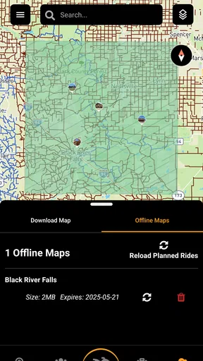
Some functions may continue working when you are offline, particularly if relevant route information has already been loaded or saved on your device. Nevertheless, features such as browsing updated trail data, syncing activity, or accessing online content generally require an internet connection. If you plan to ride in a remote area, prepare beforehand and do not rely on the app as your only source of navigation.
Is Trailz – Let’s Ride! free to download and use?
Trailz – Let’s Ride! may be available to download at no initial cost, but the exact features, advertisements, subscriptions, or optional purchases can vary depending on the platform and current app-store listing. Before installing, check the Google Play Store or Apple App Store page for the latest pricing and payment details. Also review subscription terms carefully if premium tools are offered.


